

ISRO’s 20-in-1 mission successful
Indian Space Research Organisation (ISRO) on Wednesday launched in a single rocket a total of 20 satellites, including two student satellites from Indian universities and 17 satellites of four foreign countries.
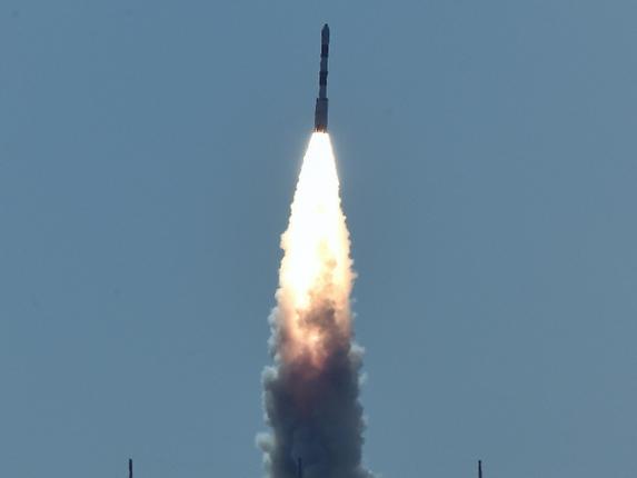
The space agency’s PSLV C-34 rocket lifted off at 9.25 a.m. from the Second Launch Pad in Satish Dhawan Space Centre and some 16 minutes later placed Cartosat-2 Series satellite about 505 km above the Earth’s orbit. Within the next 10 minutes, the remaining 19 satellites were eventually placed in the intended orbits.
Soon after the launch, ISRO chairman A.S. Kiran Kumar said, “With this mission, we have launched the current generation Earth observation satellite along with 17 satellites from foreign countries.”
Satish Dhawan Space Centre Director P. Kunhikrishnan said that it was a “major milestone” for ISRO to launch 20 satellites in a single mission.
Prime Minister Narendra Modi congratulated the space agency, describing the launch as an “monumental” accomplishment.
“20 satellites in a go! @isro continues to break new barriers. Hearty congratulations to our scientists on the monumental accomplishment’, he said on Twitter.
The 725.5 kg-weighing Cartosat-2 series satellite would be used for Earth observation. According to ISRO, the imagery sent by the satellite will be useful for cartographic applications, urban and rural applications, coastal land use and regulation, utility management like road networking.
It may be recalled that ISRO had in 2008 launched 10 satellites in a single rocket. On April 28, 2008, its PSLV-C9 rocket launched a Remote Sensing satellite CARTOSAT-2A along with Indian Mini Satellite (IMS-1) and eight nanosatellites.
The vehicle will not only put 20 satellites into the same orbit — the highest number of satellites to be put into orbit by a PSLV — but it will perform two tricky experiments of the same nature. Fifty minutes after the satellites are injected into the orbit from the fourth stage of the vehicle, its engine will be re-ignited for five seconds.
Top 10 facts:
» India’s earth observation spacecraft Cartosat-2 Series satellite and 19 co-passenger satellites together weighing about 560 kg at lift-off would be injected into a 505 km polar Sun Synchronous Orbit.
» The primary satellite to be carried by PSLV C-34 rocket is similar to Cartosat-2, 2A and 2B satellites launched earlier. The imagery to be sent by the satellite would be useful for cartographic applications, coastal land use and regulation, utility management like road networking, water distribution, creation of land use maps, precision study, change detection to bring out geographical and manmade features and various other Land Information System and Geographical Information System applications.
» LAPAN-A3 (Indonesia): The microsatellite is for Earth observation and is intended to be used to monitor land use, natural resource and environment.
» M3MSat (Canada): Maritime Monitoring and Messaging Micro-Satellite is a technology demonstrator mission jointly funded and managed by Defense Research and Development Canada (DRDC) and the Canadian Space Agency (CSA). The satellite’s primary mission is to collect and study Automatic Identification System signals from low-Earth orbit.
» GHGSat-D (Canada): Built by Space Flight Laboratory of the University of Toronto Institute for Aerospace Studies, the Earth observation satellite is meant for measuring the atmospheric concentration of greenhouse gases (Carbon Dioxide and Methane).
» BIROS (Germany): Berlin Infrared Optical System (BIROS) is a small scientific satellite from the German Aerospace Center and its mission objective is the remote sensing of high temperature events.
» SkySat Gen2-1 (U.S.): Designed and built by Terra Bella, a Google company based in Mountain View, California in the U.S., the small Earth imaging satellite is capable of capturing sub-meter resolution imagery and HD video.
» Dove Satellites (U.S.): A total of 12 Flock-2P Earth imaging satellites are to be launched in this mission. They would be packed in three dispensers.
» Sathyabamasat (Sathyabama University, Chennai): The satellite aims to collect data on green house gases.
» Swayam (College of Engineering, Pune): The satellite aims to provide point to point messaging services to the HAM (amateur radio) community.
(With inputs from agencies)
Kindly send reply or comments on this topic to [email protected]
Source:Thehindu
PSLV